Wednesday, August 31, 2011

We are making new plans

Although it hasn't been officially announced yet, it doesn't seem that the Erie Canal will open again this year.  Some of the locks have lost their doors, some have had the earth washed away from both sides of the lock.  So we are looking into other options for storing the boat this year because we can't get back to Brewerton where we were planning to store the boat.

I've taken some post-flood pictures of the scenes I included in the earlier post.  I'll put them here, but to really appreciate the size of the flood, you should go back to the previous post to see the contrast.

The view east of the Lock 2

The flooded fences in their normal state

The whole 3 tier park
Right now we still don't know when we might get out of the locks.  The Waterford city docks are still damaged and can't hold boats.  The Federal lock south of us on the Hudson is still closed because they haven't yet cleared out all the boats that hit it flowing down the river.  We also haven't heard if it was damaged.  So even though our lock works, there is no place for the 15-20 boats to go.  So here we sit.  We'll keep you informed as the adventure continues.

Monday, August 29, 2011

It's not the wind, it's the water


The rivers crested today.  I've never witnessed serious flooding before and I sincerely hope I never will again.  The speed of the water and the flooding was just amazing.  There is the street next to the dock in the morning

and here is that same street less than 3 hours later

Unfortunately, those people standing there live down that road.  One of them had to have their dog rescued by canoe.

The water in the Mohawk River is flowing 30 times faster than normal. It comes from the south and the old Erie and Champlain Canals (from the 19th century) both flow to our north.  The result is this merging of the flows in front of the lock we are behind.  Those bumps down the middle of the picture are signs on a pier you can't see providing instructions on how to enter the canal.
Facing east from Lock 2

Same view after the flooding 


Here are a few more morning and afternoon comparison shots, taken about three hours apart.
The park fence was already disappearing in the morning
But it was gone in the afternoon


Fences without flood
Park in the morning, two tiers above water

Park in the afternoon, only one tier left


Park after the water receded
I can't speak highly enough of the the NY Canal Commission.  First of all they saved us from ourselves by requiring us to come into the locks.  This picture of the docks where we were tied up says it all.  We were on the piece of the dock that is crumpled up under the bridge.  Even the piece that looks flat is six feet higher than it was Sunday morning and there is water on both sides of the dock in the picture.  Before Irene that was a six foot high concrete wall to the left of the dock.
After the hurricane
The folks from the Canal Commission were here at the lock before 11:00 AM Monday morning.  They told us where the grocery store and laundromat are and made a car available to all of us stuck here so that we can get to either if we need to.  This afternoon another Canal Commission employee came by to see if we needed water or ice.  At the next lock up, lock 3, they've put in extension cords that make it possible for every boat trapped up there to have power.  Fortunately, we have solar panels and a generator so power isn't an issue for us.  The canal toilet and shower facilities that are normally meant for the lock master have been opened to us as well.

The bad news is that we don't know how long we may be here.  It could be weeks.  We are headed west and three of the locks west of us were flooded.  No one can yet tell us when (or if) the Canal may open again.
Most of the boats stuck in here with us are headed south.  They may get to leave long before we do.  The only things keeping them here are the flooding, which will subside soon, and the federal lock on the Hudson River.  We haven't yet heard about the status of the federal lock.  Apparently the Troy Yacht Club docks broke loose and flowed down to the lock with boats still attached.  We've heard that two boats went over the 
dam and two more hit the lock gates.  We also heard that an RV floated down the river to the lock.

So until the rivers calm down a bit, we remain members of the Lock 2 yacht club with the other five pleasure boats, two Canal Commission tugs, and the City of Waterford's historic tug, the Buffalo.
Lock 2 Yacht Club


Sunday, August 28, 2011

Hurricane update - Sunday night

It rained continuously for 18 hours but we're fine and the boat is safe. The Mohawk River isn't due to crest until 6:00 PM Monday and it won't be below the flooding level until Wednesday morning. I think we're going to be here a while.

Hurricane update - Sunday morning

Well we guessed wrong. The storm came north instead of going northeast. We are now tied up in the lock flight between locks 2 and 3. Lot and lots of rain but the winds aren't predicted to go over 35 mph.

Saturday, August 27, 2011

Hurricane update - Saturday noon

Yes, we are awaiting Hurricane Irene.  I thought we would be out of hurricanes once we left the south, but noooo!  We are sitting at the community dock in Waterford, NY where the Hudson River meets the Erie Canal.  You can actually see us on the town's dock cam by clicking on http://208.125.161.182:7111/view/index.shtml.  Be patient, it takes a couple of minutes for the camera to load.

The last 24 hours have been an exercise in "what happens now?"  Yesterday the dock master here in Waterford told us that the Canal Commission would permit docking between locks 3 and 4 as a way to escape the hurricane at 7:00 AM this morning.  We asked if we had to go, or we were just being offered the option.  At that time, the dock master said it was just an option, that they would make a decision about whether or not we could stay where we are on Saturday morning.  I walked up to look at the offered space between locks 3 and 4 and it didn't look like such a great deal to me.  There was lots of space but very few things to tie up to.

Where we are now offers secure tie up on a floating dock.  That is the good news.  Where we are now is also where the Mohawk River empties into the Hudson.  We are 150 miles north of New York, so we're not actually too concerned about the wind, nor are we worried about storm surge.  There is a lock between us and the rest of the Hudson River and it would have to be a legendary storm surge to get this far up the river anyway.  Our concern here is the rain, not the rain as it falls, but the rain as it drains from the Mohawk Valley through the Mohawk River into the Hudson.  If we get a lot of rain from the storm, we'll get flooding where the rivers meet because the Hudson won't be able to absorb all of the run-off from the Mohawk.  The NY State Canal Commission has already begun preparing for possible flooding by letting water out of the Erie Canal to lower the Mohawk before the storm hits.

The dock we are on is a floating dock.  That means it rises and falls as the water level rises and falls, and the boats tied to it rise and fall with the dock.  It is the best docking situation for this type of event.  since they started lowering the Mohawk last night the water here has risen a foot.  We've got about 6-7 more feet that the dock can rise with no problems.  After spending the morning talking with each other, watching the weather forecasts, and speculating about what could happen, about half the folks who were docked here decided to move into the canal and trade the iffy tie-ups for not possibility of flooding.  The rest of us decided to stay with the secure tie-ups and hope the rain isn't as bad up here as it will be further to the east.  Waterford is on the eastern edge of the Mohawk Valley drainage system, so the hard rains would have to be west of us to cause flooding.  Even the most dire track shows the storm will be east of us and most of the tracks have the outermost edge of strong rain running up the Hudson, or east of the Hudson.  So we decided to gamble on the rains not being so bad west of us.

Now it is a wait and see game.  The irony is that for everyone else, after the storm passes it is over.  For us, the flood will arrive, if it is coming, after the storm has gone through.  So we won't know if we made the right decision until some time on Monday most likely.

Ah well, the insurance is paid up.  You pays your money and takes your chances.  Remember, you can watch it all unfold on the town dock camera.

More later.

Saturday, August 20, 2011

Out of Lake Champlain and into the Champlain Canal

After a week and a half of wandering around in Lake Champlain, we've headed south.  Last night we spent the night in Whitehall, New York, which claims to be the birthplace of the United States Navy.  This is the town where they built the boats Benedict Arnold used in the Battle of Valcour Island, the first naval battle of the Revolutionary War.  Unfortunately, Benedict lost nine of his fifteen ships, including his flagship, but we try not to focus on the bad stuff.  Now Whitehall is a small, depressed little town with no economy and few residents, but they have a great jazz band.  I'm not sure where the band came from but they had a concert in the park next to the town dock last night and those guys were good!  They were young guys, could have been the high school or community college jazz band.

On our way down the lower end of Lake Champlain, we stopped in Chipman's Point to visit Fort Ticonderoga.  We stayed at a marina that lent us a car to go to the Fort.  Many marinas are like that, they simply give you the keys to a car and trust you to bring it back.  Of course, they have your $250K boat in their marina so I guess they don't feel that lending you a junker worth maybe $3,000 is a big risk.

Ft. Ticonderoga from the water
Fort Ticonderoga is built overlooking the southern end of Lake Champlain.  Strategically, controlling this point keeps the bad guys from invading by water from either the north or the south, depending on where your enemies are.  The French built the first fort here, to keep the British south of the lake.  When Ethan Allen and the Green Mountain boys took it over in 1775, the objective was to keep the British bottled up in the north.

View from the Fort
As you can see the fort sits high over the lake, making it a perfect point from which to shell enemy boats.  The fort had 100 guns even though there were only 40 soldiers stationed here when the American Revolution started.  But it never shelled anyone.  Ethan Allen seized it May 10, 1775 and in January, 1776, an enterprising young man named Henry Knox offered to bring the guns from Ticonderoga to Boston to help break the British control of Boston.  After the guns were removed, the fort never played another role in the revolution. By the 1820s it had fallen into complete disrepair.  It only exists today because a wealthy family bought the property to build a summer home and decided to restore the fort.

We're about half way through the eleven locks of the Champlain Canal.  By the middle of the week we'll be back in Waterford, NY and ready to go back through the Erie Canal.  Slowly but surely the summer is drawing to a close.

Pictures from the Montreal to Lake Champlain run

I finally got around to downloading the camera and found a few fun photos from our Montreal and Richelieu run.

Down Time and the go fast boat
This first picture shows a boat that docked next to us in Montreal.  We figured the paint job alone probably costs tens of thousands of dollars.  And they probably spent more on the gas to get to Montreal than we will spend on fuel for the entire summer.

Ginny Belle in the Richelieu Canal
This a a picture of a boat we traveled with for a while.  Ginny Belle is a 27 foot boat that is probably 11 feet wide.  Down Time is 15 feet wide.  As you can see from Ginny Belle going through this open swing bridge, the Richelieu was very narrow in spots.  We also found that the lock tenders on the Richelieu were given to letting the water into the locks at quite a brisk rate.  Unfortunately, Down Time danced around quite a bit in the roiling water even with both of us holding on as tightly was we could.  The locks on the Richelieu are both short and narrow which means that when we locked through with other boats everyone was quite tense.  The Richelieu was not my favorite canal.

But we did see one interesting thing on the Richelieu we didn't see anywhere else, a fish ladder.  As you can see from the description below, a fish ladder is designed to let fish swim upstream past a dam.  There has been a canal in this area since the 1820s and the canal and dam design has always allowed for the spawning migration of the fish and eels that call this area home, until the current dam was built in the 1969.  This fish ladder was added to the side of the dam giving the fish a way to swim over the dam.  On one side of the ladder there are specially designed tubes to support migrating eels.

Fish ladder


Tuesday, August 9, 2011

Montreal and south to the U.S.

From St-Anne we headed back down the St. Lawrence River to Montreal.  This section of the trip actually takes place in the St. Lawrence Seaway, the canals and locks created by the Canadian government to enable large ships to pass by the rapids on the St. Lawrence River.  Although the locks don't lower you much, they are huge because they are meant to be used by ocean-going and lake freighters, many of which are over 400 feet long.  Because the primary purpose of the Seaway is to support commercial shipping, they have designated times each day when they will lock pleasure boats through. There wasn't much commercial shipping underway the day we moved (we only saw one freighter locking through at our last lock), so we were actually taken into the locks shortly after we arrived rather than waiting an hour for the designated time.

After you exit the lock near Montreal, you have to turn west, against the river current, to get to the marinas in Montreal.  Small boats and sailboats can't do it, they don't have enough engine power to push into the current.  We barely made it; at one point we were doing less than 3 knots (contrast that with our usual cruising speed of 7.5 knots).  and the water was quite lumpy because the river current was flowing around islands and intersecting with the Seaway waters.

We spent four days in Montreal but Jim's shingles are really acting up, causing him quite a bit of pain, so we didn't really do much.  I don't think he ever got more than a block from the boat.  I took my morning walks through Vieux Montreal (Old Montreal), some of which was built as early as the 1640s.  Vieux Montreal looks a lot like Paris with wider streets.  I also walked through some of Underground Montreal which connects most of the street level shopping, the universities and the subway through underground walkways that cover most of the downtown area.  Once you get there, say on a subway from the burbs, you never have to go out into the weather to get all over the city.  Great in the snowy winter, and not too bad in the heat of summer either.

From Montreal we made a quick three day run to the U.S.  Going down river from Montreal to Sorel you have the river current flowing with you, so we were actually making 9-10 knots all the way down the river.  At Sorel you enter another series of rivers and canals, generally referred to at the Richlieu Canal, that takes you straight south to Lake Champlain and the U.S. border.  It is the only water border where U.S. Customs and Border Patrol stops and boards every boat.  It is also an extremely active border.  The CBP agent who came aboard Down Time told me they had checked in 75 boats between 10:00 AM and 1:00 PM that day.

So now we are wandering around Lake Champlain.  Our first stop was a marina just past the Customs dock where we could hit a pharmacy for a pain prescription for Jim and a grocery store to re-stock the food. (Did I ever mention how expensive food was in Canada? Ouch!)  It felt like we hadn't left Canada yet.  There were no American licenses plates on any of the cars in the parking lot and the only language you heard on the docks was French.  It is much easier for the Quebecois is this area to keep their boats in the U.S. and drive over the border than to cross the border on the water.  The only U.S. boats in this marina were cruisers who had just come back from Canada.

We'll gradually make our way down Lake Champlain to the Champlain Canal, then back into the Hudson River.  Now that we are back in the U.S. we actually have mobile broadband again, so I'll be able to post a bit more frequently. It is good to be home!

Tuesday, August 2, 2011

Ottawa River to Montreal

It is a good thing we had a close destination planned when we left Ottawa.  It actually took us 5 1/2 hours to clear the Ottawa lock flight, four hours of waiting for the up-bound boats and 1 1/2 hours to lock down to the Ottawa River. We finally left Ottawa about 1:45 PM.

 During the four hours of waiting, the sun was out, the sky was blue.  By the time we got into the lock, it was pouring rain.  I shouldn't complain, we've had such great weather most of the trip, but locking in the rain sucks.  Jim gets to stand under the after deck cover.  I'm standing out in the rain at the mid-ship cleat.

Through the quarry cut
Our plan for the evening was to hang out on a free dock available at a local casino.  The casino was built next to a mined out quarry, which they flooded to create a marina.  To get into the marina you have to take your boat through a blasted out hole in the wall of the quarry.  You also have to get under a 19 foot bridge, so the boats that get in there don't tend to be too large.  Down Time was put on the "big boat" dock to give us plenty of room.  After all those years in Florida where a 36 foot boat is considered small, it is very strange to suddenly be one of the big boats.

Early the next morning we left and headed down the Ottawa River.  It was easy and pleasant boating, little wind, calm water, wooded shore lines some with houses, others on islands that are wildlife sanctuaries.  As many of you know, I lived in Arizona for years and Canadians flock to Arizona for the winter.  I now understand the attraction.  It must seem like being on the moon to them after Canada.  Everything is green and growing here, everywhere you look.

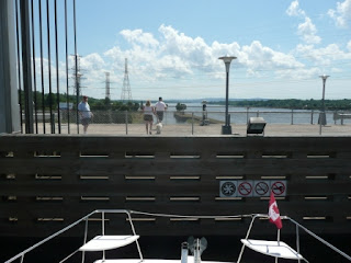
Chateau Montebello entrance
The Ottawa River is not very long.  At our typical speed it is an easy two day trip.  For our one night stop along the way, we went to Chateau Montebello which bills itself as the world's largest log cabin.  This picture of the entrance doesn't begin to give you the sense of its size.  I tried to take a picture of the interior reception area which is three stories high with a four-sided fireplace that must be eight feet across, but it was too dark in there for my little digital camera to handle.  It is an interesting place, it is a family resort destination; you go there to hangout for a week, there is nothing around it.  Your room rental includes golf, kayaking, swimming pools, horseback riding, hiking trails, etc.  You can sign-up for classes in any of the above.  They even have a Land Rover driving school for folks who want to play off-road driver.

Carillion Lock loaded - at the top
Along the Ottawa River you encounter two locks, the deepest lock in the system and the shallowest.  Interestingly enough, they both operate differently from the locks on the Rideau Canal.  On the Rideau you loop lines around cables attached to the canal walls and adjust the lines by hand as the boat rises or falls with the water.  In the Ottawa River locks you tie up to a dock in the lock and the dock itself raises or lowers.  In the Carillion Lock this is a good thing because the lock is 65 feet deep.  Because it is so deep, it takes a long time to fill or empty it, so they really pack the boats in with each locking.  This is where being one of the big boats really comes in handy because they put the big boats into the lock first and tie them off to them floating dock. Then they bring in the smaller boats and tie them to the sides of the bigger boats.

Looking out before starting down
We were actually the first boat in so we were at the front of the lock with a view down river before they started letting the water out.  About half way through the locking process, this is how our view had changed.
Half way down
That is the same gate we were looking over when the process began.  At the end of the locking, this is what it looked like.
At the bottom of 65 feet
The downstream wall is a 200 ton guillotine gate that raises up, dripping water over everybody who passes under it at the end of the locking.  This is how it appeared to us from the deck of the boat after we had reached the bottom of the lock, before they opened it to let us out.
Looking up at the guillotine gate
The other lock on the Ottawa River, the Sainte-Anne lock, uses the same floating dock technology, but only raises or lowers you one foot.

The day from Chateau Montebello to Sainte-Anne was our longest day of this trip.  We left at 7:30 AM and didn't get to Sainte-Anne until after 5:00 PM.  We had planned to spend the next day in Sainte-Anne which worked out well because it was overcast and rainy all day.